
The World of the Ancient Near East
Historical & Biblical Background
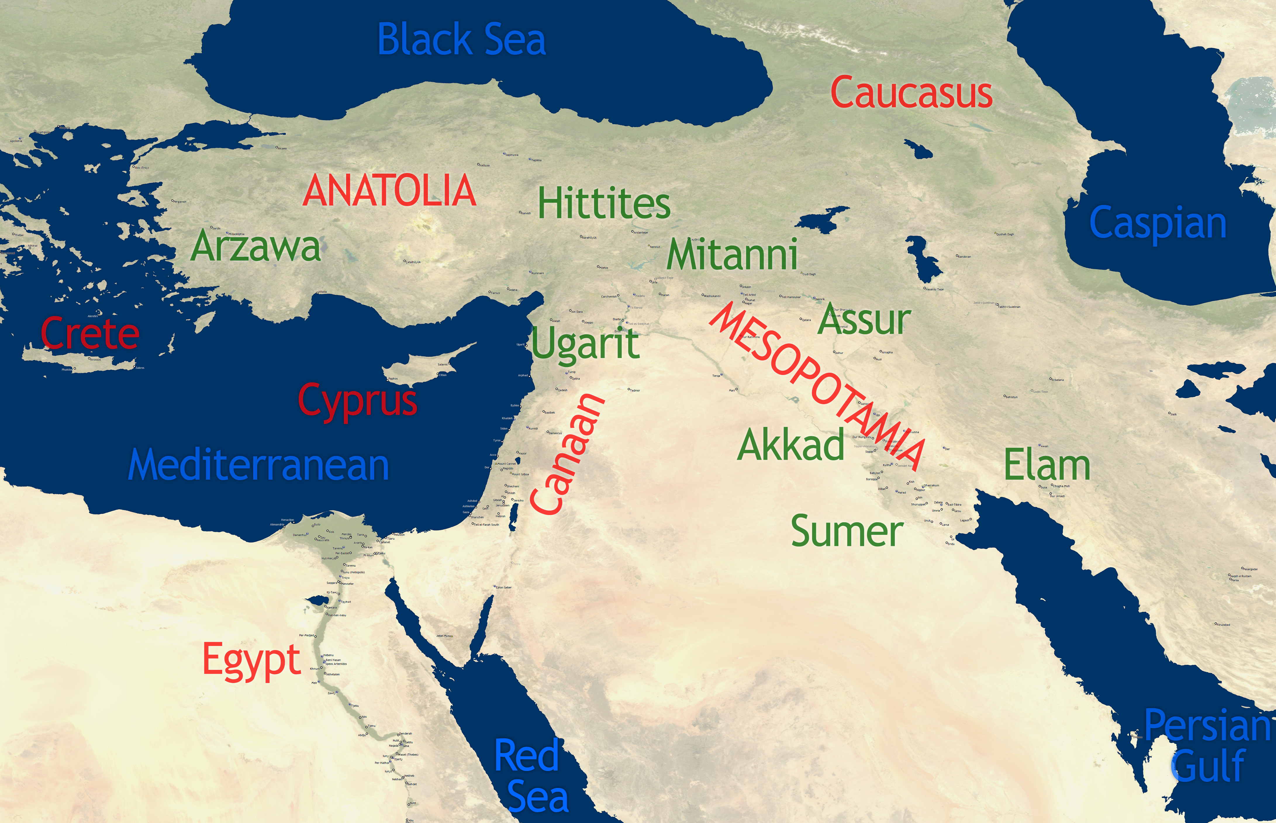
This satellite map places the major civilizations of the biblical world in their true geographical context — the actual terrain, rivers, deserts, and coastlines that shaped everything from Abraham's journey to the Babylonian exile. The Ancient Near East is not an abstraction. It is a real place, and this map shows it as it actually looks from space — the green valleys of Mesopotamia, the barren Sinai desert, the narrow coastal strip of Canaan, the unmistakable ribbon of the Nile winding through the Egyptian desert.
The Land Bridge at the Center
The most important feature on this entire map is the narrow strip of land labeled "Canaan" — the land God gave to Abraham and his descendants. Notice its position: squeezed between the Mediterranean to the west and the desert to the east, it forms the only practical land bridge connecting Africa (Egypt) to Asia (Mesopotamia). Every army, every merchant, every ambassador traveling between the two great civilizations of the ancient world had to pass through or near Canaan. God placed His people at the crossroads of history.
The Great Civilizations
The regions labeled on this map represent the great civilizations that shaped biblical history. Sumer — visible at the head of the Persian Gulf — gave the world its first writing, its first cities, and its first law codes. Akkad built the world's first empire. The Hittites of Anatolia forged iron and built an empire that rivaled Egypt. Mitanni dominated northern Syria and the upper Euphrates. Each of these civilizations intersected with Israel's story — as oppressors, neighbors, employers, enemies, or instruments of God's judgment.
Geography as Theology
For the ancient Israelites, geography was inseparable from theology. The land was not merely real estate — it was covenant territory, promised by God to Abraham (Genesis 15:18–21), conquered by Joshua, lost through disobedience, and promised to be restored in the last days. Every mountain, river, and border on this map carries theological weight. The Jordan River is a boundary of covenant. The Euphrates marks the furthest extent of the promised land. The desert between Egypt and Canaan is the wilderness of testing and transformation.
"In the same day the LORD made a covenant with Abram, saying, Unto thy seed have I given this land, from the river of Egypt unto the great river, the river Euphrates."— Genesis 15:18 (KJV)
Key Scripture References
Genesis 15:18–21 — The boundaries of the Promised Land — from Egypt to the Euphrates
Genesis 11:31 — Abraham's family journeys from Ur through Mesopotamia to Haran
Deuteronomy 11:24 — "Every place whereon the soles of your feet shall tread shall be yours"
Isaiah 19:24–25 — Egypt, Assyria, and Israel — a blessing in the midst of the land
Ezekiel 5:5 — "This is Jerusalem: I have set it in the midst of the nations"
Acts 17:26 — God determined the appointed times and boundaries of all nations