
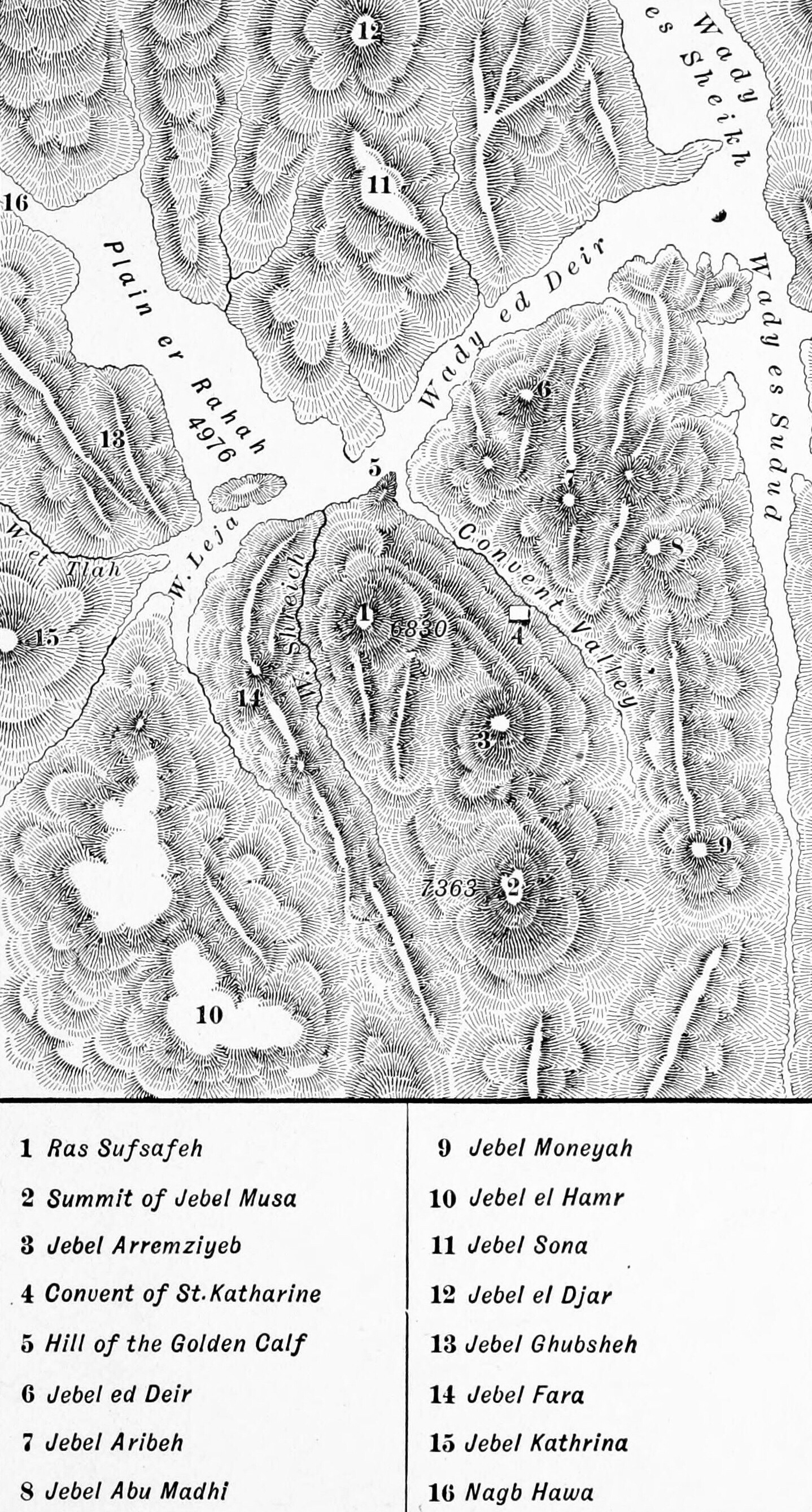
This detailed map shows the Sinai massif with a precision that lets you understand exactly what Israel saw and experienced. Find the Plain of er-Rahah on the left side of the map — this is where Israel camped. Now look at what rises immediately to its east: the cliff face of Ras Sufsafeh (#1), dropping hundreds of feet to the plain below, with Jebel Musa summit (#2) rising higher behind it. The mountain is not a gentle slope. It is a wall of granite rising over 7,000 feet, visible from the plain in its full terrifying height.
God's instructions to Moses before the revelation were precise and sobering. The people were to be consecrated — washed, made ready — for two days. Bounds were to be set around the mountain: no one was to touch it, on pain of death. Not even an animal. Even Moses himself, when God spoke, was to come up but then descend and bring Aaron with him. The mountain was holy ground of the most severe kind.
On the third day: thunder, lightning, thick cloud, and a trumpet blast so loud that the people trembled. Smoke covered the mountain. It quaked. God descended in fire. And He spoke — audibly, directly, to the entire assembled nation — the Ten Commandments. After the commandments, the people were so overwhelmed that they fell back and begged Moses to serve as their mediator. Moses then entered the thick darkness where God was, and received the detailed body of the Law over forty days.
Find the Hill of the Golden Calf (#5) on the map — near the plain, at the base of the approach to the mountain. Moses was gone forty days. The people grew anxious and demanded Aaron make them a god. He collected their gold earrings, cast a golden calf, and declared: "These be thy gods, O Israel, which brought thee up out of the land of Egypt." Moses descended with the two stone tablets — written by the finger of God — saw the calf and the dancing, and threw the tablets down, breaking them. The rebellion at the very foot of the mountain where God had just spoken is one of the most staggering acts of faithlessness in the entire Bible. God offered to destroy the nation and start over with Moses. Moses interceded. And God relented.