
Find Abel Shittim on the east bank of the Jordan — Israel's final camp before crossing. Look across the river to Jericho on the west bank. That is the distance Israel had been marching toward for forty years. The Jordan was the last barrier. The manna was still falling every morning. The cloud was still resting over the Tabernacle. But the wilderness chapter of Israel's story was about to end.
The Plains of Moab were Israel's final wilderness staging ground, and a great deal happened there. The census of Numbers 26 counted the new generation — none of the men twenty and above from the Egypt generation were left except Caleb and Joshua, exactly as God had decreed. Moses delivered the sermons recorded in Deuteronomy — the great covenant renewal address, retelling the entire wilderness story for the generation that had grown up in it. The cities of refuge were designated. The inheritance of the Transjordanian tribes was settled. The daughters of Zelophehad established the law of female inheritance. Moses wrote the Law and gave it to the Levites for safekeeping.
And then God told Moses to go up on Mt. Nebo and look at the land — because Moses would not be crossing. At the waters of Meribah-Kadesh, Moses had struck the rock instead of speaking to it as God commanded, and had said "must we fetch you water out of this rock?" — taking credit for the miracle rather than giving it to God. The consequence was severe: "Because ye believed me not, to sanctify me in the eyes of the children of Israel, therefore ye shall not bring this congregation into the land" (Numbers 20:12). The greatest leader in Israel's history would see the land but not enter it.
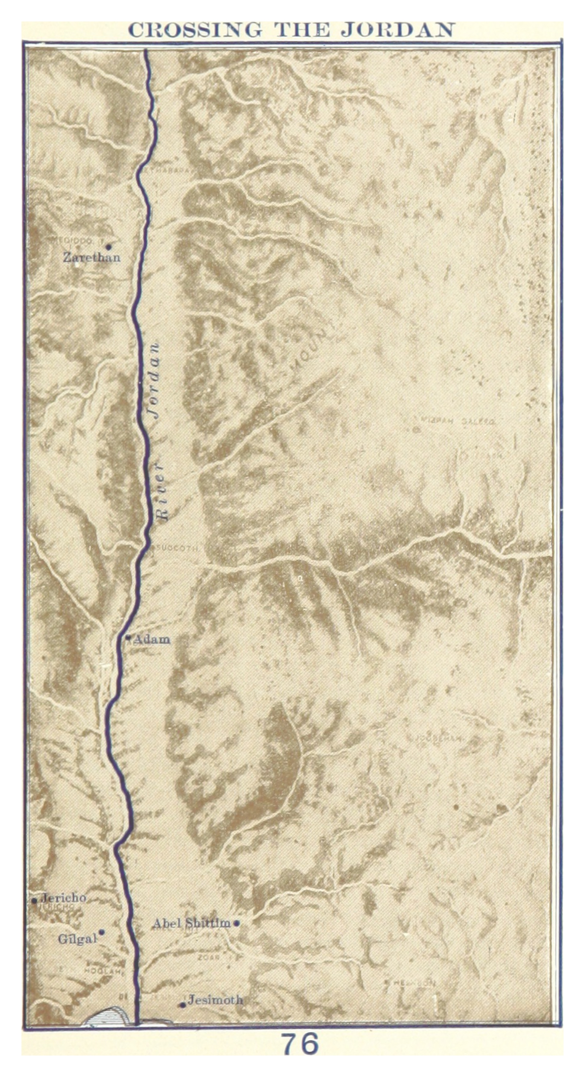
Find the city of Adam on this map — in the center of the Jordan. This is where the waters piled up when Joshua led the crossing. The priests carried the ark to the water's edge. Their feet touched the Jordan — and the river stopped. An entire nation walked across on dry ground, just as their parents had crossed the Red Sea forty years before. Find Gilgal on the west bank. That was the first ground Israel's feet touched in the land of promise. The manna stopped the day after they ate the produce of Canaan for the first time. Forty years of daily miracle ended the morning they no longer needed it.