
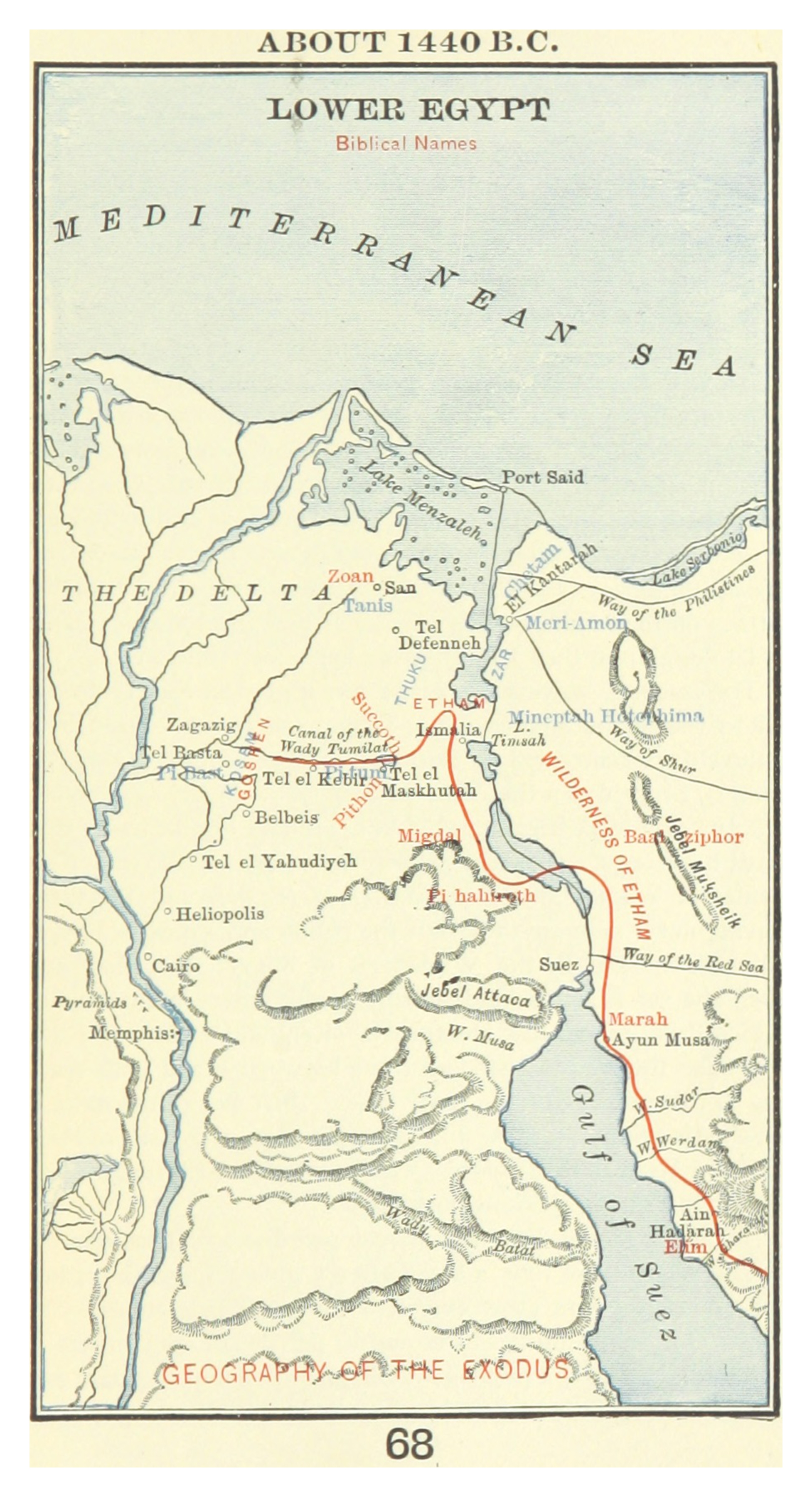
The Land of Goshen is one of the most geographically specific regions named in the patriarchal narratives — and this map gives you a precise picture of where it was. Look at the eastern Nile Delta. The Canal of the Wady Tumilat runs through the center — this fertile valley, watered by a branch of the Nile, is the likely heartland of Goshen. It was ideal for shepherds and their flocks. The ground was green. Water was abundant. The distance from the royal court at Zoan/Tanis was manageable.
When the family of seventy arrived, Pharaoh was welcoming. Joseph was the second most powerful man in Egypt. The Hyksos Pharaohs — themselves Semitic immigrants who had seized power in Egypt — may have been particularly open to other Semitic peoples settling in the Delta. The Israelites thrived. Genesis 47:27 records: "And Israel dwelt in the land of Egypt, in the country of Goshen; and they had possessions therein, and grew, and multiplied exceedingly." This was God's promise to Jacob at Beer-sheba being fulfilled: "I will there make of thee a great nation."
But Exodus 1:8 introduces the turn with one of the most chilling phrases in Scripture: "Now there arose up a new king over Egypt, which knew not Joseph." The Hyksos were expelled from Egypt around 1550 BC, and native Egyptian dynasties regained power. To a new Pharaoh, the Israelites were not guests — they were a demographic threat. "Behold, the people of the children of Israel are more and mightier than we: Come on, let us deal wisely with them; lest they multiply... and... fight against us" (Exodus 1:9–10). The taskmasters were appointed. The bricks had to be made without straw. The male infants were ordered killed.
Find Tel el Maskhutah on the map — "Succoth" is labeled nearby. This is the likely site of Pithom, one of the two store-cities Israel built with forced labor. The Nile Delta you are looking at was built, in significant part, by Israelite slaves. For four hundred years — from Jacob's arrival to the Exodus — this fertile corner of Egypt was both the cradle and the prison of God's chosen people. The very abundance that made Goshen desirable also made it a trap.