
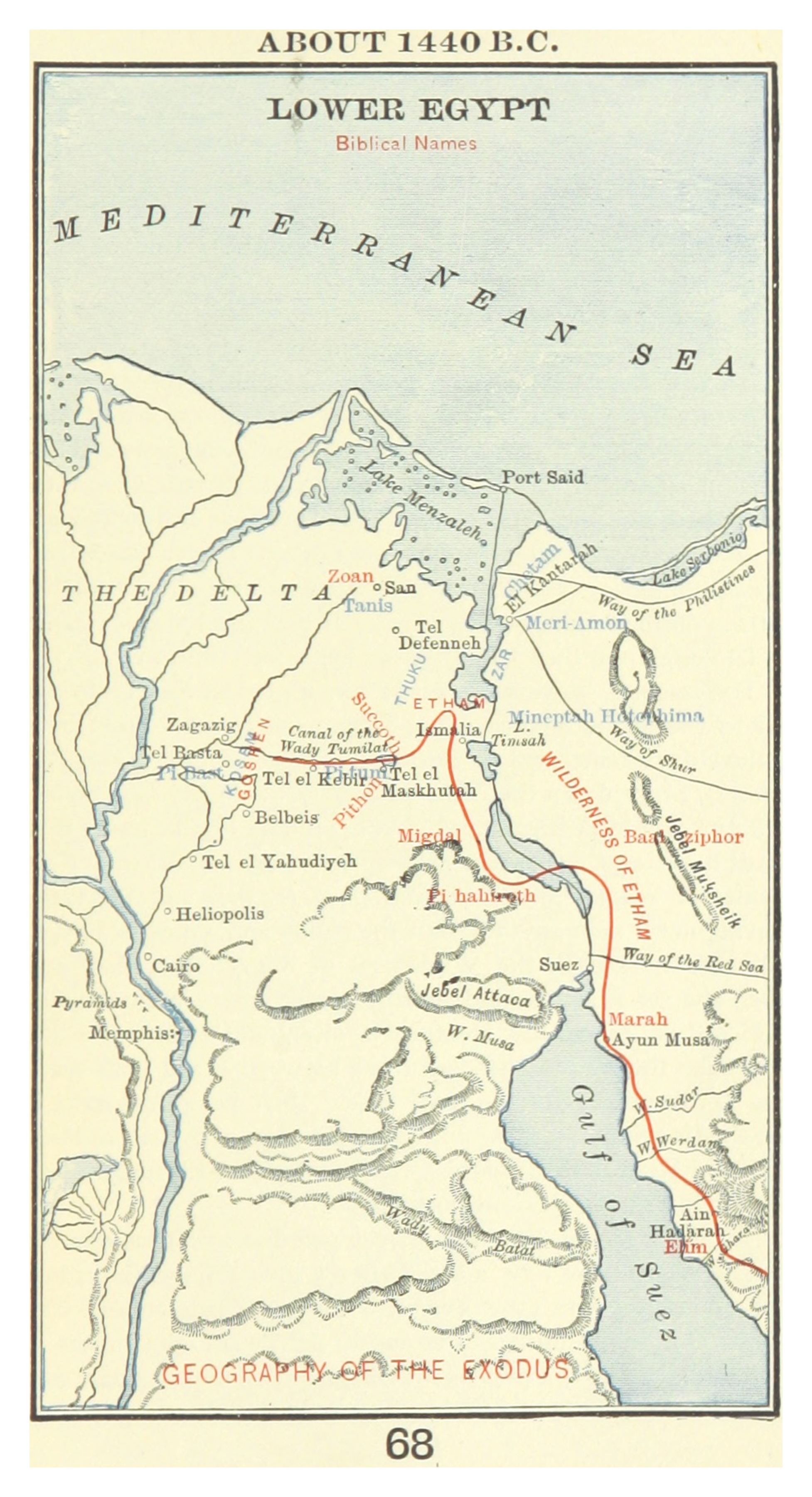
Look at the red line on this map. It traces the first steps of the most significant mass movement of people in the ancient world — the Exodus of Israel from Egypt. The route begins at Zoan/Rameses in the upper Delta — find it highlighted in red at the top of the map. This is where Israel had labored for decades making bricks for Pharaoh's building projects. On the night of the tenth plague — the death of every Egyptian firstborn — they left.
Exodus 12:37 gives the number: "six hundred thousand on foot that were men, beside children." Add women, children, and the "mixed multitude" that came with them (Exodus 12:38), and the total was likely over two million people — plus their flocks and herds. Egypt woke up the morning after the Passover to the sound of national mourning and found its workforce gone. "There was not a house where there was not one dead" (Exodus 12:30). Pharaoh called Moses and Aaron in the night and said: "Rise up, and get you forth from among my people... and go, serve the LORD, as ye have said. Also take your flocks and your herds... and be gone."
Follow the red line south from Rameses. Find Succoth — Israel's first camp, just south of the Goshen region. From there they moved to Etham, "at the edge of the wilderness" — the boundary between the Delta and the Sinai desert. But then God gave a strange command: turn back. Go toward Pi-hahiroth, between Migdal and the sea. Find Pi-hahiroth on the map, east of the Delta near the water. This looked like a tactical error — Israel appeared trapped with the sea ahead and the Egyptian army coming behind. It was not an error. It was a setup.
The ten plagues that preceded the Exodus were not random acts of power. They were systematic demolitions of the Egyptian pantheon — each plague striking at a specific Egyptian deity. The Nile turned to blood (Hapi, the Nile god, judged). The sun went dark (Ra, the sun god, silenced). The firstborn died (Pharaoh himself, considered divine, broken). By the time Israel walked out of Rameses, Egypt had been judged not just politically but theologically. The gods of Egypt had been shown to be nothing before the God of Israel.