
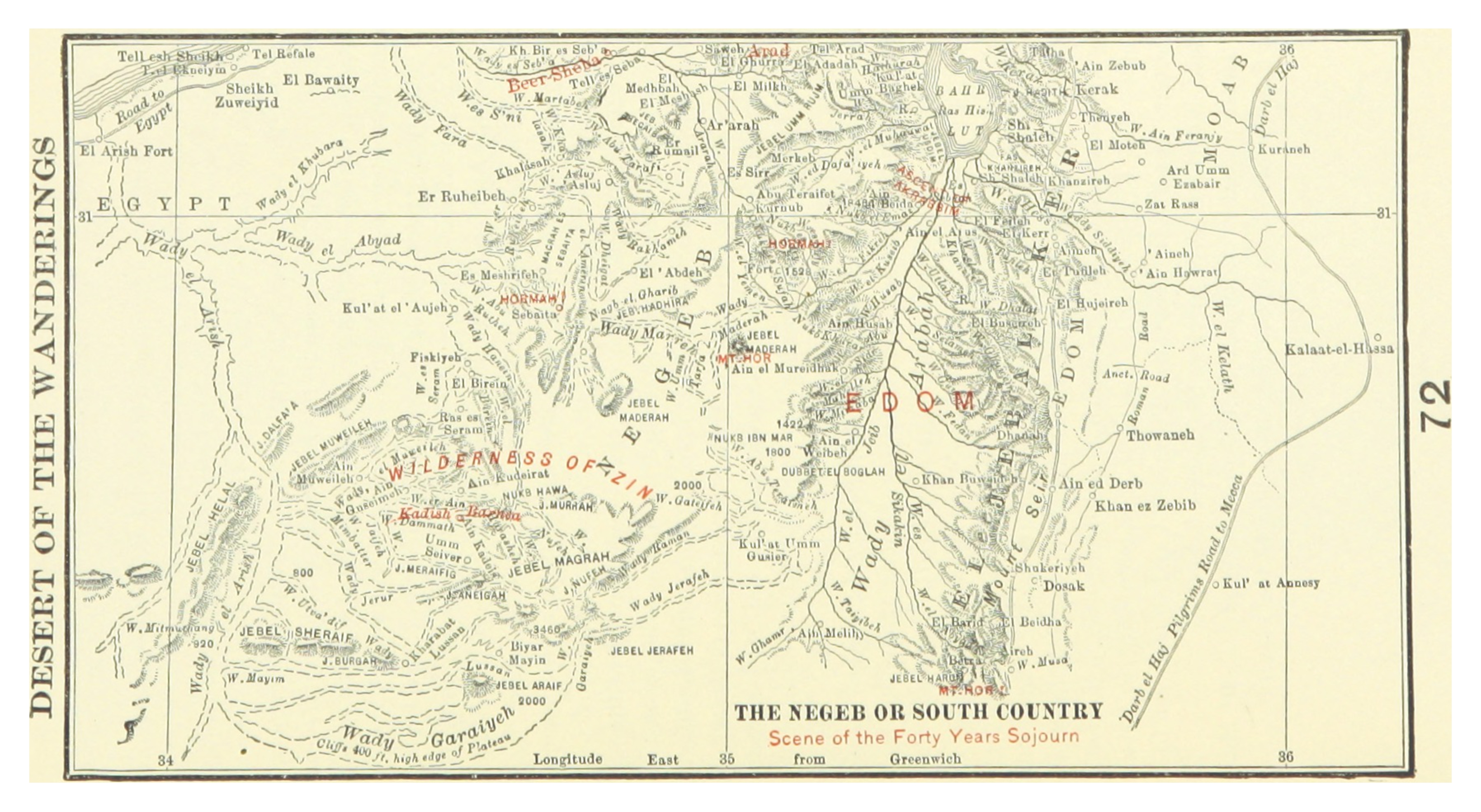
This map shows the central stage of Israel's forty years of wilderness wandering. Find Kadesh-Barnea in the lower-left, highlighted in red — this oasis in the Wilderness of Zin was Israel's main base. It was from here that the twelve spies were sent into Canaan. It was here that the people received their report and rebelled. And it was here, at the end of forty years, that they assembled again for the final push toward the land.
The forty years were not aimless wandering. Numbers 33 lists forty-two specific campsites — a precise itinerary of every stop. God was accomplishing something specific: allowing the generation that had refused to trust Him at Kadesh to die in the wilderness, while raising up a new generation that had never known Egypt and had spent their entire lives dependent on God for water, manna, protection, and direction. The wilderness was not a detour — it was a curriculum.
Find Hormah on the map, labeled in red. This was the site of the first humiliation: right after the rebellion, when Israel tried to force their way into Canaan without God's blessing, they were crushed here by the Amalekites and Canaanites. God had said He would not go with them. They went anyway. The defeat at Hormah was the immediate consequence of faithless presumption — the mirror image of faithless refusal. Both failed; both were punished. The lesson: God's timing and God's presence are not optional add-ons to human plans.
Find Mt. Hor on the map and Edom to its east. Near the end of the forty years, Aaron died on Mt. Hor after his priestly garments were transferred to his son Eleazar. Then Israel asked Edom for passage — find Edom's territory on the map's right side — and were refused. They circled south around Edom, then east through Moab, then north along the eastern side of the Dead Sea toward the Plains of Moab. Every mile of the detour was because Edom, Israel's own kinsmen, refused to let them through. The same map that shows Israel's wilderness home also shows the nations that shaped its final approach to the land.